Interactive Property Map
Explore the properties within Cool Cliff Valley. Move your pointer over a highlighted lot to emboss the parcel on the map and reveal its quick details, or click/tap a lot for more information.
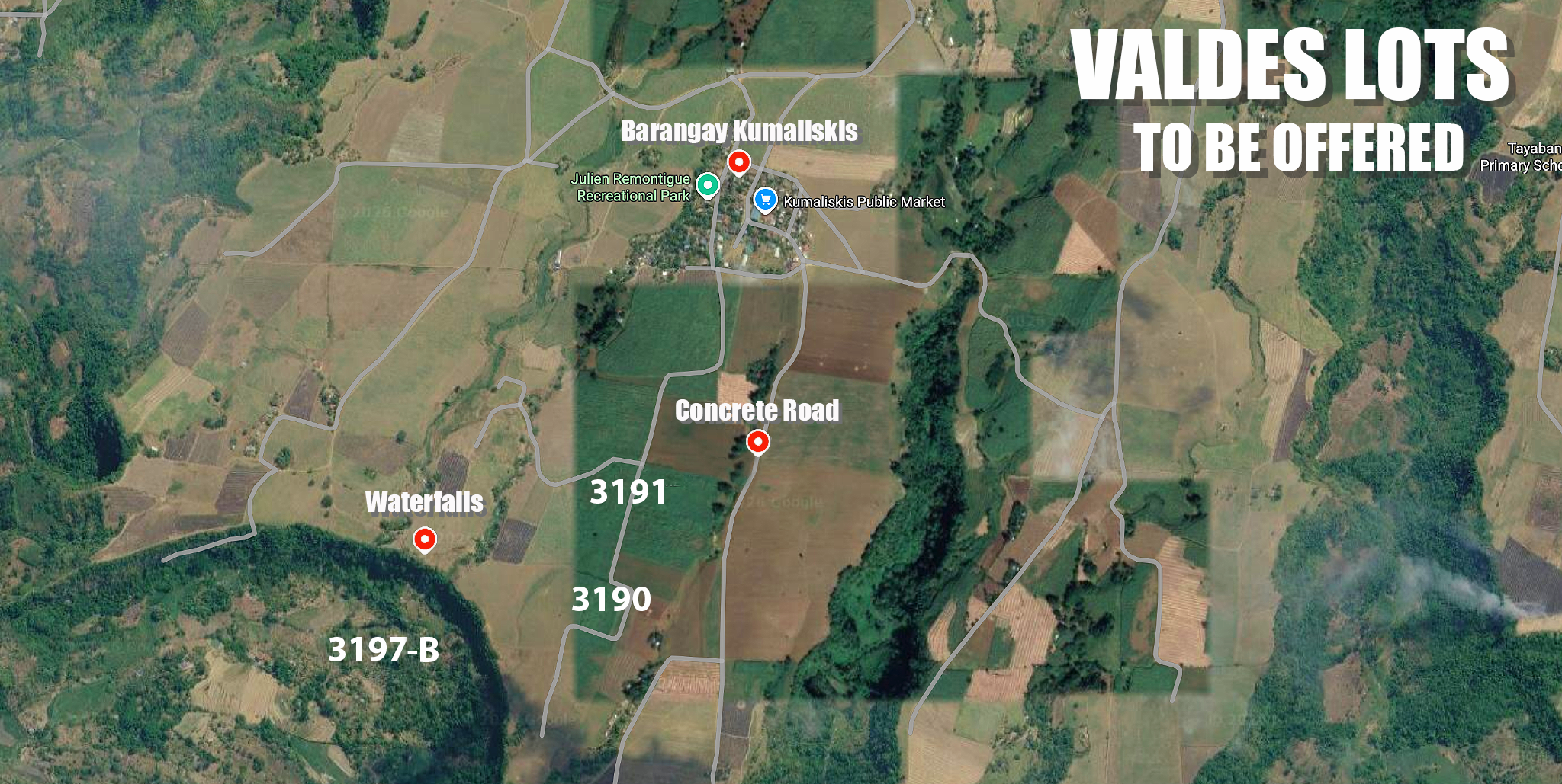

Lot 3190 (Plan Lot 2)
Property in Brgy. Kumaliskis, Don Salvador Benedicto, Negros Occidental. The survey shows road frontage along the eastern side.
- Area
- 77,825 sq.m. (approximately 7.78 hectares)
- Plan
- Lot 2, Plan H-190560 / Lot No. 3190 of San Carlos Cadastre
- Status
- Available for sale
- Pricing
- Contact us for details
Photos & Video

Lot 3191
Property in Brgy. Kumaliskis, Don Salvador Benedicto, Negros Occidental. The survey places Lot 3190 immediately to the south.
- Area
- 79,090 sq.m. (approximately 7.91 hectares)
- Plan
- Lot 3191, San Carlos Cadastre
- Status
- Available for sale
- Pricing
- Contact us for details
Photos & Video

Lot 3197-B
Portion of Lot 3197 in Brgy. Kumaliskis. The survey shows a road along the western boundary and neighboring Lots 3190 and 3189 to the east.
- Area
- 123,073 sq.m. (approximately 12.31 hectares)
- Plan
- Portion of Lot 3197, San Carlos Cadastre
- Status
- Available for sale
- Pricing
- Contact us for details
Photos & Video

Lot 3174-B
Portion of Lot 3174 in Brgy. Kumaliskis. The survey shows road access along the western side and a creek along the eastern side.
- Area
- 146,933 sq.m. (approximately 14.69 hectares)
- Plan
- Portion of Lot 3174, San Carlos Cadastre
- Status
- Available for sale
- Pricing
- Contact us for details
Photos & Video

Lot 54-B
Portion of Lot 54 in Brgy. Kumaliskis. The survey identifies the Nibalian River along the eastern/southeastern property boundary.
- Area
- 89,401 sq.m. (approximately 8.94 hectares)
- Plan
- Portion of Lot 54, PLS-675
- Status
- Available for sale
- Pricing
- Contact us for details
Photos & Video
Property placement on this interactive map is an approximate visualization based on available survey plans, vicinity maps and satellite imagery. Official survey and title documents govern legal boundaries.